C-MAP 4D CHARTS AVAILABLE FOR RAYMARINE AXIOM
Latest Software Update Brings Premium Worldwide Charts and New Benefits to Raymarine Axiom Multifunction Displays
[print_link]
C-MAP, a leader in digital marine cartography and cloud-based mapping, announced today that the Raymarine Axiom series of multifunction displays is now compatible with the brand’s latest offerings, including the powerful C-MAP 4D MAX and 4D MAX+ cartography.
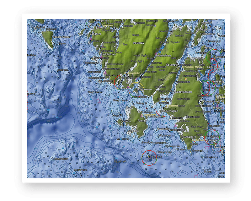
C-MAP offers the most advanced navigational features for any cruising, fishing or sailing needs, including up-to-date Vector Charts, Easy Routing and High Resolution Bathymetry on 4D MAX; and Dynamic Raster Charts, Satellite Imagery and 3D-View with 4D MAX+. Packed with innovative features designed to enhance every cruising, fishing or sailing experience, these charts offer local and wide coverage areas worldwide and are available at a budget that suits all boating styles.
“We are constantly striving to offer the unique functionality of our cartography catalog to a larger audience of users through building strong relationships with an ever-expanding collection of OEM partners,” said Matt Johnson, C-MAP Product Manager. “C-MAP is an all-in-one charting solution and our C-MAP 4D MAX and 4D MAX+ chart packages offer features navigators require, at an excellent value to consumers, tailored specifically to their particular needs.”
C-MAP gives boaters the option of full-feature vector charts including depth areas and contours, spot soundings, navaids, aerial photos, detailed port plans and more. The Dynamic Raster Charts give users a traditional paper chart presentation for easy location recognition. Satellite image overlay provides real-world reference and enhances situational awareness for simple coastal navigation. C-MAP 3D-View offers stunning three-dimensional views of land elevation and bottom contours to bring the world to life. High-Resolution Bathymetric views offer the highest available detail of underwater pinnacles, ledges and canyons that attract offshore and coastal gamefish. The Easy Routing feature automatically plots the shortest, safest route between two waypoints for fast and efficient navigation.
C-MAP 4D is available in local and wide coverage areas worldwide on a micro SD card. Charts are available in multiple languages. For more information on C-MAP, C-MAP 4D MAX and C-MAP 4D MAX+, please visit www.c-map.com.
– 30 –
About C-MAP:
C-MAP offers the world’s largest marine navigation digital chart database helping its customers explore the digital options and address the complexity of marine operations by providing integrated, intelligent information. C-MAP covers the world with accurate, up-to-date electronic charts, value-added data and services that let you sail safely to distant horizons, fill the boat with fish, or cruise with confidence. C-MAP cartography is compatible with the latest navigation systems offered by the world’s top Marine Electronics manufacturers. For more information, please visit www.c-map.com.
The C-MAP group of companies, owned by Digital Marine Solutions Holding AS (DMS), is located in 9 countries. DMS is owned by Altor Private Equity and investment Bank Goldman Sachs. The group is trading its products under the C-MAP brand.

Easy Routing


