INAVX ANNOUNCES AVAILABILITY OF NAVIONICS+ CHARTS IN THE INAVX IN-APP CHART STORE
[print_link]
The Most Powerful Marine Navigation App Now Offers Even More Chart Options for iOS Users
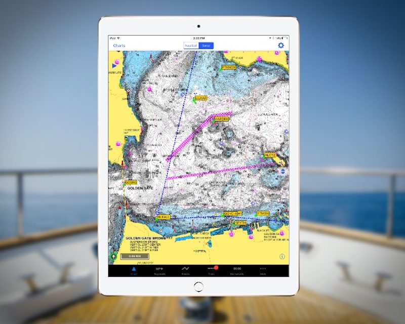
San Francisco, Calif. – iNavX, the benchmark marine navigation mobile application, announced today, in partnership with Navionics, the availability of Navionics+ charts in the iNavX In-App Chart Store. This is another first for the industry and solidifies iNavX as the premier and market leading marine navigation application available.
Navionics+, a powerful electronic chart solution for navigators – provides greater content and access to more marine areas and lakes than other products on the market, and ensures that content remains up to date. With Navionics+, users can select the most accurate navigational data – an exclusive one-foot HD bathymetry map – from one of seven extensive global regions. For the U.S. & Canada region, boaters can choose both freshwater and saltwater charts throughout the entire region. Navionics+ chart features include both Nautical Chart and SonarChartTM.
“We are constantly pushing the envelope to offer our users an unparalleled level of capabilities and options when it comes to the charts that they can use. No other marine navigation application offers users the breadth of chart provider choices,” said Shaun Steingold, CEO, NavX Studios. “With their Navionics+ charts, Navionics has proven again why they are the most popular chart provider. We are honored to partner with them and bring their award-winning charts to our iNavX users.”
“iNavX is an ideal pairing with our award-winning Navionics+ charts,” said Don Black, senior vice president of global sales and marketing at Navionics. “The extensive iNavX user base will reap the ample rewards of safer boating and more successful fishing thanks to the combination of intuitive navigation and incredible accuracy.”
iNavX is the leading marine navigation app and the only application that supports hundreds of worldwide charts from all the top chart providers. The perfect marine navigation chartplotter that also fits in the palm of your hand, iNavX can be used as a full-color chartplotter, a toolkit or as a redundancy system. The feature-rich app is capable of displaying current position in real-time using a mobile device’s built-in GPS, as well as plotting course, bearing and waypoints. Supporting NMEA data over TCP/IP, iNavX also integrates with external GPS, AIS receivers and transponders, and networked instruments including depth, speed, wind, engine data, and battery voltage meters. Users can easily manipulate data by panning, zooming and rotating charts, as well as downloading GRIB weather forecasts.
Availability
iNavX is available for Apple iPhone, iPod Touch and iPads from the App Store, and is priced at $24.99. Worldwide Navionics+ Charts are available for purchase within iNavX. Prices vary by region. For more information on iNavX, contact press@inavx.com or visit www.inavx.com.

